Category:Askham Richard
Jump to navigation
Jump to search
village and civil parish in the City of York in the north of England  | |||||
| Upload media | |||||
| Instance of | |||||
|---|---|---|---|---|---|
| Location | City of York, North Yorkshire, Yorkshire and the Humber, England | ||||
 | |||||
English: Askham Richard is a village and civil parish in the unitary authority of City of York in the north of England, six and a half miles south west of York, close to Copmanthorpe, Bilbrough and Askham Bryan. Prior to 1996 it formed part of the district of Selby. The village became a Conservation Area in 1975. Nearby is Askham Bryan College of Agriculture.
Subcategories
This category has the following 4 subcategories, out of 4 total.
B
- Buckles Inn, York (10 F)
F
- Fields in Askham Richard CP (18 F)
R
- Rose & Crown, Askham Richard (9 F)
S
Media in category "Askham Richard"
The following 69 files are in this category, out of 69 total.
-
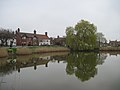 A Reflective village pond at Askham Richard - geograph.org.uk - 3915972.jpg 4,000 × 3,000; 2.19 MB
-
 A64 westbound - geograph.org.uk - 3929986.jpg 640 × 480; 52 KB
-
 Approaching Askham Richard - geograph.org.uk - 2872778.jpg 640 × 480; 140 KB
-
 Approaching the junction - geograph.org.uk - 1707773.jpg 640 × 480; 189 KB
-
 Askham Grange Manor.jpg 1,024 × 768; 606 KB
-
 Askham Richard - geograph.org.uk - 1343132.jpg 640 × 480; 101 KB
-
 Askham Richard - geograph.org.uk - 1988548.jpg 800 × 600; 270 KB
-
 Askham Richard - geograph.org.uk - 248171.jpg 640 × 479; 98 KB
-
 Askham Richard village pond - geograph.org.uk - 187986.jpg 640 × 480; 77 KB
-
 Askham Richard village pond - geograph.org.uk - 2505959.jpg 640 × 426; 74 KB
-
 Askham Richard windmill-geograph.org-2297876.jpg 2,592 × 3,888; 5.35 MB
-
 Askham Richard.jpg 600 × 450; 95 KB
-
 Autumnal willow beside the pond - geograph.org.uk - 5611136.jpg 640 × 427; 306 KB
-
 Bales beside York Road - geograph.org.uk - 6379727.jpg 1,024 × 639; 429 KB
-
 Barn, Askham Fields Farm - geograph.org.uk - 2729594.jpg 640 × 480; 97 KB
-
 Bradley Grange - geograph.org.uk - 3779230.jpg 1,024 × 768; 160 KB
-
 Bridleway through fields near Colton - geograph.org.uk - 4114102.jpg 1,024 × 768; 270 KB
-
 Buttacre Lane, Askham Richard - geograph.org.uk - 447198.jpg 640 × 480; 74 KB
-
 Cat Lane near the A64 - geograph.org.uk - 5341581.jpg 640 × 427; 191 KB
-
 Cherry Blossom Trees, Askham Richard - geograph.org.uk - 434452.jpg 640 × 387; 88 KB
-
 Country road - geograph.org.uk - 4741025.jpg 640 × 480; 39 KB
-
 Country road - geograph.org.uk - 4741027.jpg 640 × 480; 48 KB
-
 Entering Askham Richard - geograph.org.uk - 5611133.jpg 640 × 427; 286 KB
-

-
 Farm buildings on Mill Lane, Askham Richard - geograph.org.uk - 4834864.jpg 1,200 × 799; 317 KB
-
 Farm track towards Poplar Lodge - geograph.org.uk - 2649877.jpg 1,600 × 1,200; 489 KB
-
 H M Woman Prison - geograph.org.uk - 1988561.jpg 800 × 600; 331 KB
-
 Home Farm near Askham Richard - geograph.org.uk - 4834791.jpg 1,200 × 799; 389 KB
-
 Lane towards Stock Hill - geograph.org.uk - 3854561.jpg 1,600 × 1,200; 964 KB
-
 Low Moor Lane - geograph.org.uk - 1707776.jpg 640 × 480; 197 KB
-
 Mill Lane towards York Road - geograph.org.uk - 4834873.jpg 1,200 × 799; 426 KB
-
 Mill Lane towards York Road - geograph.org.uk - 4834877.jpg 1,200 × 799; 385 KB
-
 Mill Lane towards York Road - geograph.org.uk - 4834879.jpg 1,200 × 799; 337 KB
-
 Mill Lane, Askham Richard - geograph.org.uk - 4834857.jpg 1,200 × 799; 294 KB
-
 Mill Lane, Askham Richard - geograph.org.uk - 4834868.jpg 1,200 × 799; 430 KB
-
 Old Joiners cottage - geograph.org.uk - 1988567.jpg 800 × 600; 331 KB
-
 Old Joiners Cottage, Askham Richard - geograph.org.uk - 4834826.jpg 1,200 × 799; 416 KB
-
 Ordnance Survey Bench Mark, Stock Hill, Askham Bryan - geograph.org.uk - 2297899.jpg 3,888 × 2,592; 6.42 MB
-
 Out of Askham Richard - geograph.org.uk - 3915982.jpg 4,000 × 3,000; 3.51 MB
-
 Path across field drain near Bilbrough Lodge - geograph.org.uk - 4804705.jpg 3,072 × 1,728; 4.91 MB
-
 Path leading to Askham Richard - geograph.org.uk - 4834792.jpg 1,200 × 799; 400 KB
-
 Path leading to Askham Richard - geograph.org.uk - 4834793.jpg 1,200 × 799; 483 KB
-
 Path leading to Askham Richard - geograph.org.uk - 4834821.jpg 1,200 × 799; 661 KB
-
 Pond in Askham Richard - geograph.org.uk - 2874505.jpg 640 × 480; 106 KB
-
 Primary School, Askham Richard - geograph.org.uk - 5450389.jpg 1,600 × 1,200; 549 KB
-
 Road and Duck Pond - geograph.org.uk - 5611141.jpg 640 × 427; 241 KB
-
 Road to Angram - geograph.org.uk - 5611145.jpg 640 × 427; 221 KB
-
 School Lane into Askham Richard - geograph.org.uk - 3915974.jpg 4,000 × 3,000; 3.28 MB
-
 School Lane towards Askham Richard - geograph.org.uk - 2726953.jpg 640 × 480; 86 KB
-
 Snowdrops at Askham Richard - geograph.org.uk - 4834817.jpg 1,200 × 799; 547 KB
-
 Stile at Askham Richard - geograph.org.uk - 4834801.jpg 1,200 × 799; 572 KB
-
 Stock Hill trig point - geograph.org.uk - 2749442.jpg 1,024 × 696; 170 KB
-
 The duckpond, Askham Richard - geograph.org.uk - 447200.jpg 640 × 480; 77 KB
-
 The road to Askham Richard - geograph.org.uk - 3779235.jpg 1,024 × 768; 124 KB
-
 The road to Rufforth - geograph.org.uk - 1988580.jpg 800 × 600; 203 KB
-
 The track to the mast - geograph.org.uk - 1988531.jpg 800 × 600; 350 KB
-
 The Village Pond, Askham Richard - geograph.org.uk - 5026460.jpg 1,600 × 1,067; 619 KB
-
 The Village water pump - geograph.org.uk - 1988553.jpg 800 × 600; 308 KB
-
 The Weir at Askham Richard - geograph.org.uk - 4834839.jpg 1,200 × 799; 466 KB
-
 Village Green - geograph.org.uk - 5611135.jpg 640 × 427; 224 KB
-
 Village Water Pump and covered seating - geograph.org.uk - 3915963.jpg 4,000 × 3,000; 3.3 MB
-
 Waterlogged path at Askham Richard - geograph.org.uk - 4834797.jpg 1,200 × 799; 553 KB
-
 York Road heading east - geograph.org.uk - 2729597.jpg 640 × 480; 60 KB
-
 York Road heading east - geograph.org.uk - 2729601.jpg 640 × 480; 82 KB
-
 Askham Richard Village Centre - geograph.org.uk - 178939.jpg 600 × 450; 103 KB
-
 Hagg House Farm - geograph.org.uk - 178898.jpg 600 × 450; 75 KB
-
 Road Junction near Bilbrough - geograph.org.uk - 187983.jpg 640 × 480; 98 KB
-
 Stockhill Cottages - geograph.org.uk - 178947.jpg 600 × 450; 75 KB
-
 ^2 Stockhill cottages - geograph.org.uk - 1988540.jpg 800 × 600; 240 KB


